The field notes
A journey with rhythm
Private guiding, thoughtful pacing, and enough room to absorb each place rather than simply pass through it.
PrivateThoughtfulLocal

Kathmandu Trekking Itinerary 4 Days/3 Nights
Walk from Shivapuri’s forest trails to Namo Buddha and Panauti through four days of village life, hill scenery and Himalayan horizons close to Kathmandu.
Journey overview
The Kathmandu Valley Cultural Trek is a four-day, point-to-point walking journey through the green hills surrounding Nepal’s capital. It is designed for travellers who want meaningful trail time, village landscapes and cultural encounters without committing to a remote or high-altitude trek. The route begins with a short drive from Kathmandu to Sundarijal and ends in Panauti, followed by a private return transfer to Kathmandu.
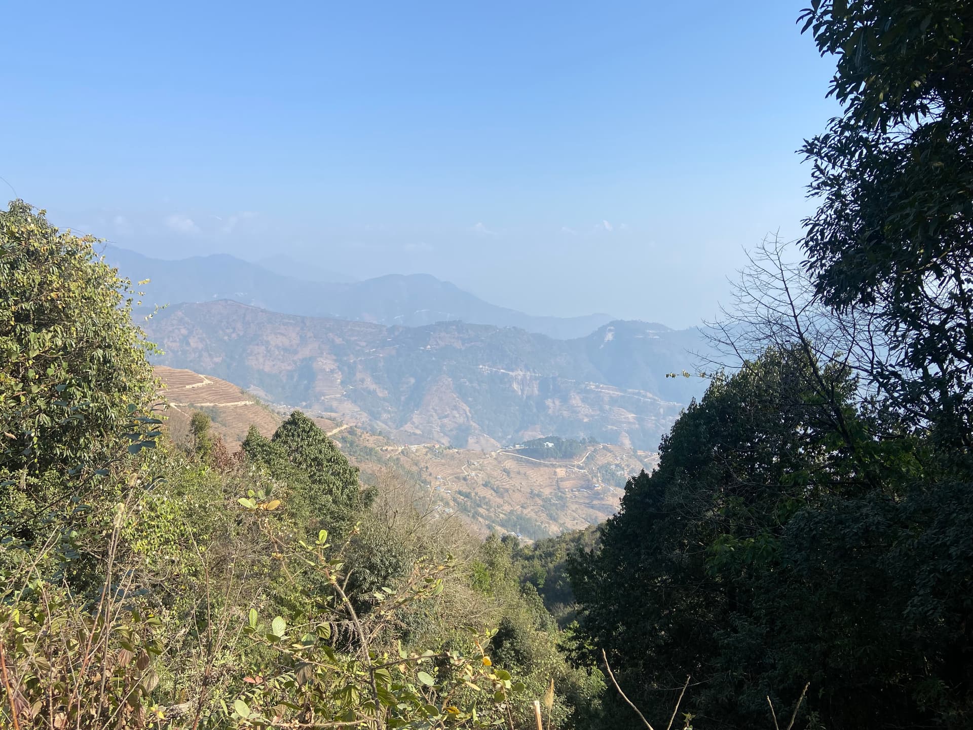
The first day leads into Shivapuri Nagarjun National Park, where stone steps and forest paths climb above Sundarijal. After passing Mulkharka, the route reaches Borlang Bhanjyang at approximately 2,425 metres, the highest point of the journey, before descending to Chisapani. When the sky is clear, Chisapani provides wide views across the surrounding hills and distant Himalayan ranges.
The Chisapani to Nagarkot stage is the longest day of this four-day Kathmandu Valley trek. It follows an undulating route through forest, small settlements and cultivated ridges before reaching Nagarkot. The hill station is best known for its sunrise and mountain views, although visibility always depends on the season and weather. The following Nagarkot to Dhulikhel trek crosses another sequence of forests, terraced fields, villages and quiet country roads. Some road walking is unavoidable as development continues along the valley rim.
The final day brings the journey’s strongest spiritual and architectural experiences. From Dhulikhel, you walk through rural countryside to Namo Buddha, an important Buddhist pilgrimage site associated with the story of a prince’s compassionate sacrifice. After visiting the sacred area and Thrangu Tashi Yangtse Monastery, the trail descends toward Panauti, a historic Newar town known for its traditional streets, temples and sacred river confluence.
This is a low-altitude trek, but it should not be described as effortless. The complete route covers approximately 65–75 kilometres, depending on the trails, hotel locations and diversions used. Most days involve five to eight hours of walking, with stone steps, sustained climbs, uneven descents and long rolling sections. A reasonable level of fitness and comfortable, broken-in walking shoes are necessary.
Accommodation consists of a simple lodge in Chisapani and comfortable hotels in Nagarkot and Dhulikhel. Spring and autumn generally provide the most favourable walking conditions and clearer mountain views. Winter departures are also possible with warm clothing, while summer brings greener scenery but wetter and more slippery trails. Kathmandu accommodation, airport transfers and sightseeing can be added before or after the trek when required.
Trip highlights
Enter Shivapuri Nagarjun National Park at Sundarijal and climb through protected forest to Chisapani.
Follow a continuous walking route through Chisapani, Nagarkot and Dhulikhel instead of returning to Kathmandu each evening.
Watch the sunrise and look across the distant Himalayan ranges from Chisapani and Nagarkot when the weather is clear.
Walk through terraced farmland, wooded ridges and lived-in hill communities on the Nagarkot–Dhulikhel trail.
Visit sacred Namo Buddha before completing the journey among the temples and traditional streets of historic Panauti.
Places covered
The places this journey moves through, in the order they shape the experience.
Day by day
Walk the route one day at a time — meals, overnight stays, and the details that shape each stage.
Meet your guide at your Kathmandu hotel and drive northeast to Sundarijal, the starting point of the trek. After completing the Shivapuri Nagarjun National Park entry formalities, begin climbing beside the wooded slopes above the settlement.
Stone steps and village paths lead toward Mulkharka, where you can stop for lunch or refreshments. From here, continue through forest toward Borlang Bhanjyang, the highest point of the entire journey. The trail then descends through the trees to Chisapani.
Chisapani is a small ridge settlement overlooking forested hills and distant mountain horizons. Settle into the best available local lodge and, if the weather remains clear, watch the evening light across the surrounding ridges. Sundarijal: approximately 1,350 m Chisapani: approximately 2,175 m Highest point: Borlang Bhanjyang, approximately 2,425 m Driving: 45–60 minutes Walking: approximately 13–16 km, 5–6 hours Meals: Lunch and dinner Accommodation: Lodge or teahouse in Chisapani
NoteFull Board
Wake early for a possible sunrise and Himalayan view before breakfast. The walk towards Nagarkot follows a long, rolling route through the Chisapani area, Jhule, Chauki Bhanjyang, Jarsing Pauwa and other small settlements.
The landscape changes between forest trails, cultivated hillsides and quiet village roads. Although the overall elevation at Chisapani and Nagarkot is similar, the trail includes repeated ascents and descents, making this the longest and most demanding walking day.
Stop for lunch along the route before continuing toward Nagarkot. On arrival, check into your hotel and rest. Depending on the season and visibility, you may have sunset views across the hills and distant Himalayas.
Nagarkot: approximately 2,175 m Walking: approximately 20–23 km, 6–8 hours Meals: Breakfast, lunch and dinner Accommodation: Hotel in Nagarkot
Rise before breakfast to watch the sunrise from Nagarkot when conditions are favourable. After breakfast, begin the Nagarkot to Dhulikhel trek through a combination of wooded paths, terraced farmland, ridge settlements and rural roads.
The exact trail may vary because new roads and seasonal changes can affect older walking tracks. Your guide will choose the most suitable available route, generally passing through the Rohini Bhanjyang area before continuing across the cultivated hills toward Dhulikhel. Travellers should expect both natural trail and paved or unpaved road sections.
Arrive in Dhulikhel during the afternoon. If time and energy permit, take a short walk through the old town, where traditional houses, temples and narrow streets reflect its long-standing Newar heritage.
Starting elevation: approximately 2,175 m Dhulikhel: approximately 1,550 m Walking: approximately 16–20 km, 6–7 hours Meals: Breakfast, lunch and dinner Accommodation: Hotel in Dhulikhel
After breakfast, leave Dhulikhel on foot and follow village paths through terraced farmland and wooded countryside toward Namo Buddha. The route climbs gradually to the sacred hilltop, where you will visit the pilgrimage area and Thrangu Tashi Yangtse Monastery.
Your guide will explain the Buddhist story associated with Namo Buddha and allow time to appreciate the monastery and surrounding landscape. After lunch, descend through rural settlements and farmland toward Panauti.
Explore the historic centre of Panauti, including its traditional streets, temple architecture and sacred confluence area. The town provides a culturally fitting conclusion to the four-day journey. Meet your private vehicle in Panauti and return to your hotel in Kathmandu, where the trek ends.
Namo Buddha: approximately 1,750 m Panauti: approximately 1,340 m Walking: approximately 18–20 km, 6–7 hours including visits Driving: approximately 1½–2 hours Meals: Breakfast and lunch Tour ends: At your Kathmandu hotel
Private vehicle & English-speaking guide throughout · Kathmandu
Trip essentials
A clear split between what we arrange and what you budget yourself.
Before you go
Continue exploring

2 DAY(S) · 1–12 PAX
NEPAL TRIP FROM KATHMANDU 2026 |GUIDED TOUR PACKAGE
ancient royal cities of Kathmandu
11 DAY(S) · 1–12 PAX
HIMALAYAN TRIP FROM KATHMANDU 2026 |GUIDED TOUR PACKAGE
stupas and royal squares

4 DAY(S) · 1–12 PAX
NEPAL TRIP FROM KATHMANDU 2026 |GUIDED TOUR PACKAGE
historic Durbar Squares of Kathmandu
8 DAY(S) · 1–12 PAX
NEPAL TRIP FROM KATHMANDU 2026 |GUIDED TOUR PACKAGE
Chitwan through a canoe ride
“What more is there to say about discovering Nepal with Anapum and Himalayan Windows?…” — Nathan B

7 DAY(S) · 1–12 PAX
HIMALAYAN TRIP FROM KATHMANDU 2026 |GUIDED TOUR PACKAGE
Tiger’s Nest Monastery